Monsoon Maharashtra 2026: Why the Stall Happened and What Farmers Must Do Before Sowing
 Santosh Balgir
News
Santosh Balgir
News
Monsoon Maharashtra 2026
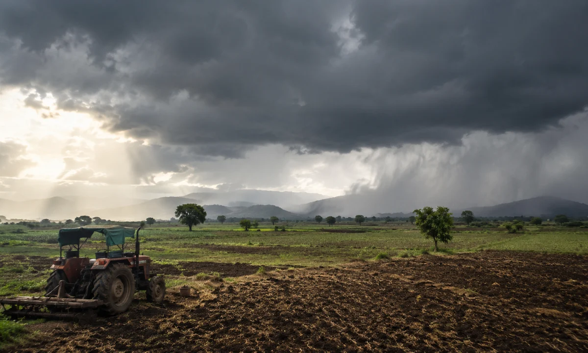
The monsoon in Maharashtra 2026 entered lower Konkan on June 6, moved swiftly to Harnai on the coast and Solapur inland, and then stopped completely. As of June 16, the Northern Limit of Monsoon has not shifted by a single kilometer in five days. What looked like a fast start has become one of the more frustrating stalls the state has seen, and the cause is specific: hot, dry winds moving in from the northwest, carrying heat and zero moisture, are neutralizing the monsoon circulation before it can push further north and east.
IMD has confirmed the stall breaks after June 18, with the monsoon expected to become active across parts of Maharashtra in the June 18 to July 2 window. Mumbai and Pune are projected to receive proper onset showers around June 20. Vidarbha, which remains under active heatwave alerts right now, will see gradual monsoon coverage spreading through the back half of that window.
Key Takeaways On Monsoon Maharashtra 2026
- The monsoon entered lower Konkan on June 6 but has been stalled at Harnai and Solapur for five consecutive days, blocked by hot, dry winds funneling down from the northwest carrying no moisture.
- IMD has confirmed the advance resumes after June 18, with Mumbai and Pune expecting active showers around June 20 and the active phase extending across the state through July 2.
- The season is forecast at roughly 90% of the Long Period Average due to El Niño, with Marathwada, Vidarbha, and Madhya Maharashtra carrying the sharpest deficit risk.
- A Positive Indian Ocean Dipole may partially offset El Niño’s suppression from July onward, but models show erratic behavior with extended dry breaks, not a steady recovery.
- Farmers in Marathwada and Vidarbha have been explicitly advised not to begin kharif sowing on pre-monsoon showers, a warning that historically gets ignored with costly consequences.
What actually caused the five-day stall
The public conversation has settled on a vague explanation: the monsoon is “slow.” The mechanism is more specific than that. Winds from the north, tracking in from drier continental air masses, have been suppressing the southwesterly monsoon flow that drives moisture inland from the Arabian Sea. When those northern winds carry heat and no moisture, they effectively push back against the monsoon’s advance without a weather system or low-pressure zone to overcome them. Until the wind pattern shifts, the monsoon boundary holds its position.
Having tracked this beat for several seasons, this type of dry-wind stall is not unusual in June. What makes 2026 different is that it is compounding an already below-normal seasonal forecast. A stall in a year with a healthy long-range outlook means a delayed start. A stall in a year shaped by El Niño means fewer recovery windows once the rains do arrive.
The revival after June 18 is expected to begin with stronger influence along the south Konkan coast before spreading northward. Vidarbha is projected to see less influence before June 25, with activity picking up in the last week of June.
The 90% figure hides a sharper regional story
IMD’s seasonal forecast for Maharashtra puts rainfall at roughly 90% of the Long Period Average for June through September. A 90% LPA figure tends to get treated as near-normal in headlines. Anyone who has followed Maharashtra’s rainfall distribution over multiple seasons knows the number conceals sharp internal variation.
The below-normal signal is not spread evenly. IMD’s probability maps show yellow to orange shading across much of Madhya Maharashtra, Marathwada, and Vidarbha, indicating a higher probability of below-normal rainfall in precisely those regions that are already the most agriculturally stressed. Some early June tracking periods showed deficits of up to 72% below normal in certain parts of the state. Konkan and coastal pockets may fare relatively better in some weeks, but the interior of Maharashtra is carrying the heaviest risk.
El Niño in the equatorial Pacific is the primary driver of this suppression. IMD has described the signal as emerging and currently weak, but with the potential to intensify into a moderate to severe phase by August. That trajectory matters because August is when Marathwada’s kharif crop is at its most water-dependent stage.
There is one counterbalance in the data that competitors have not addressed. A Positive Indian Ocean Dipole, which tends to enhance monsoon rainfall over the Indian subcontinent, may begin providing some offset from July onward. Models suggest this counterbalance will be real but inconsistent. The practical outcome is a season with more breaks than average, not a steady recovery toward normal.
Maharashtra’s split weather reality right now
The current situation in Maharashtra is being reported as a simple waiting story. The meteorological reality is more layered. The state is simultaneously experiencing heatwave conditions in Vidarbha, warm and humid conditions across Konkan and Marathwada, and isolated pre-monsoon thunderstorms in pockets of the interior. Three different weather regimes in one state at the same time.
These pre-monsoon thunderstorms in interior Maharashtra are not the monsoon. They are convective activity triggered by surface heat and atmospheric instability, not by the sustained southwesterly flow that defines actual monsoon onset. The distinction matters practically, not just meteorologically. Farmers who mistake a thunderstorm or two for monsoon onset and begin sowing risk losing seeds to a subsequent dry spell.
The sowing warning that tends to get ignored
Agronomists and IMD officials have issued an explicit advisory to farmers across Marathwada and Vidarbha: do not sow kharif seeds on the strength of pre-monsoon showers or isolated thunderstorm activity. Sowing should begin only after the region has received consistent, adequate monsoon rainfall that confirms the active phase has established itself.
This advisory is the right call. It is also the call that gets overlooked most years in the first flush of early showers when soil moisture looks encouraging and sowing pressure from seasonal calendars builds. The agricultural cost of premature sowing in a below-normal year, when early rains are followed by a dry break of ten to fourteen days, is not recoverable within that season. For small and marginal farmers in Marathwada who are already carrying debt from previous deficit years, a failed germination cycle is not a setback. It is a crisis.
The IMD has flagged this risk clearly. The window to act on it is the next ten to fourteen days.
What to watch from June 18 onward
The revival after June 18 is forecast, not guaranteed. Two things will determine whether the June 18 to July 2 window delivers what IMD projects. First, whether the dry northwestern winds that caused the current stall have fully retreated by then. Second, whether any low-pressure system develops in the Bay of Bengal in that period, which would significantly amplify monsoon activity across central and eastern Maharashtra.
Reservoir levels in Marathwada, which feed both irrigation and drinking water supply across the region, are the secondary number worth watching alongside daily rainfall figures. A delayed and below-normal season that does not produce adequate catchment rainfall in July risks a water shortage situation by late August that is more severe than the monsoon numbers alone would suggest.
The state has seen this pattern before: a late start, a mid-season burst that lifts headline totals to near-normal on paper, and a geographically uneven distribution that leaves specific districts chronically short. The forecast for 2026 has the preconditions for that outcome.




Categories
- Domestic 33
- News 9
- Info 8
- Budget Travel 5
- popular 5
- International 3
- Upcoming 1
Share This Post